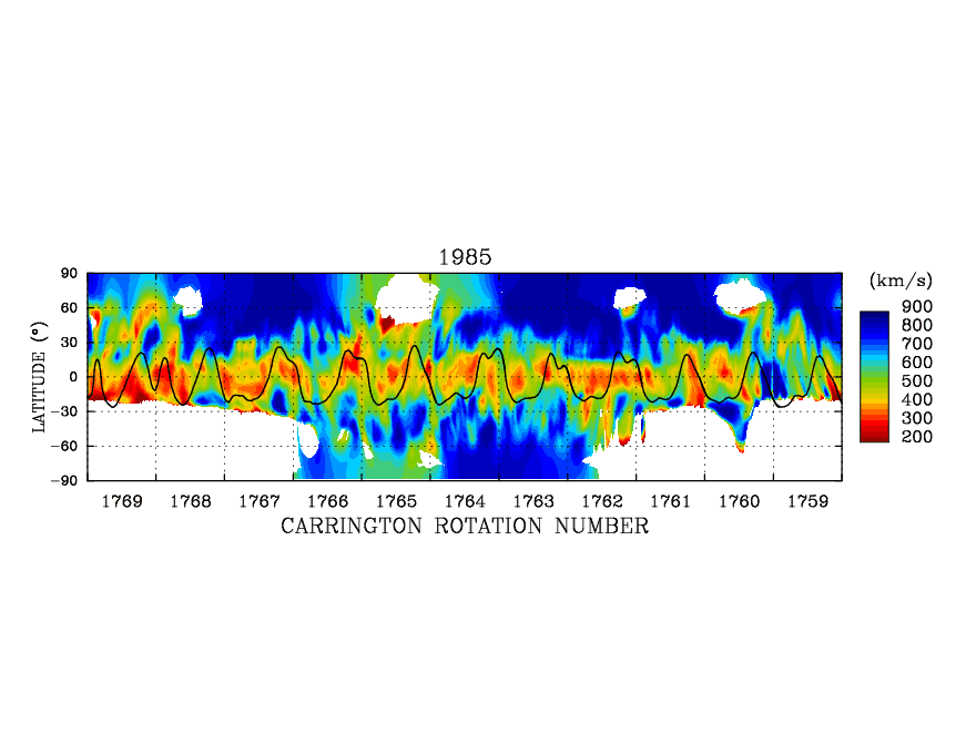
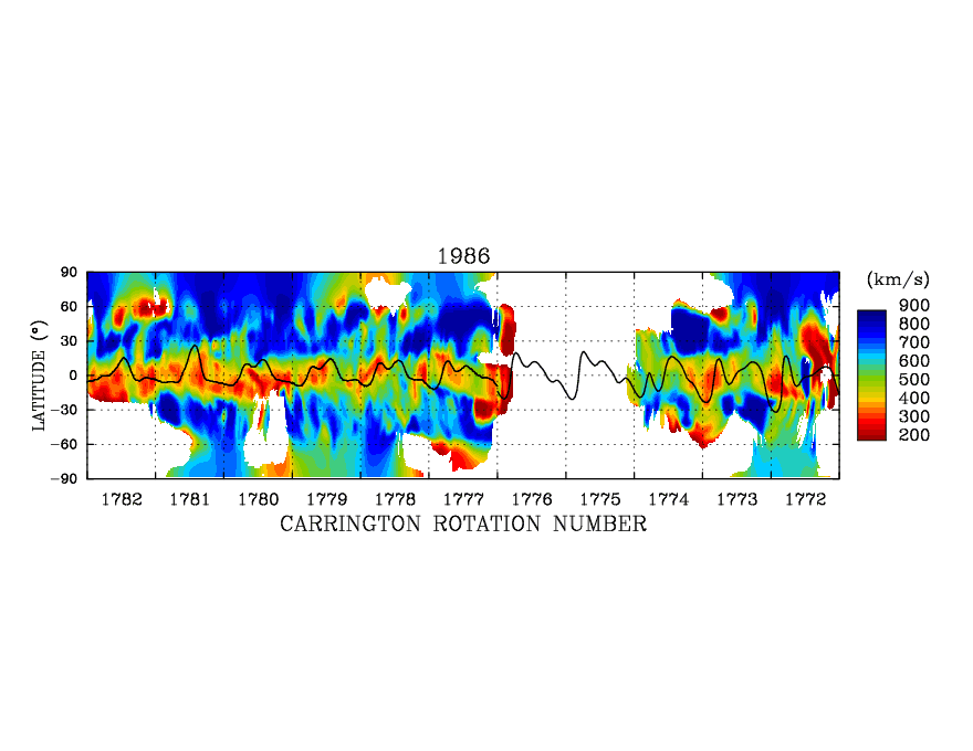
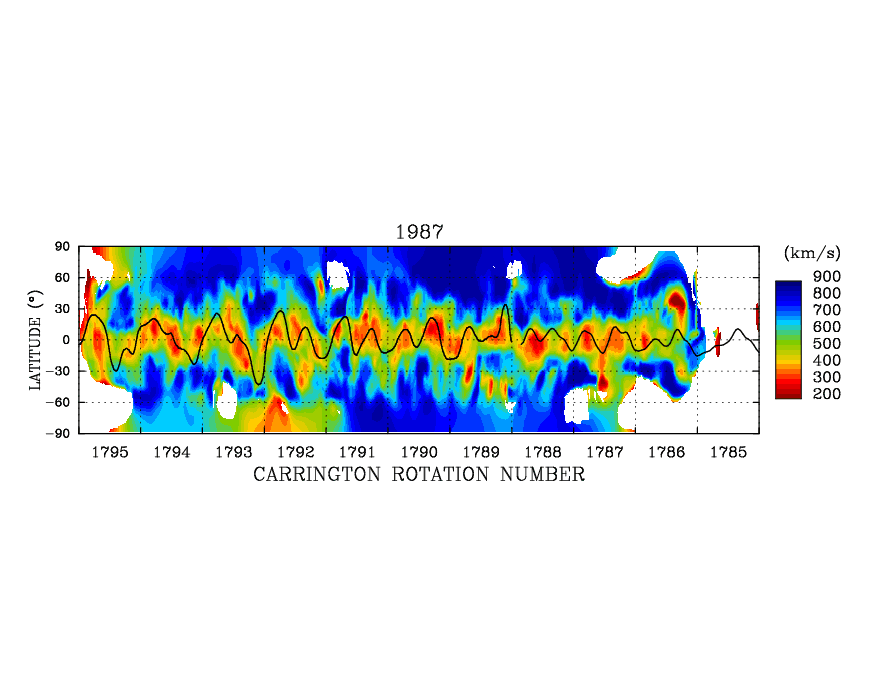
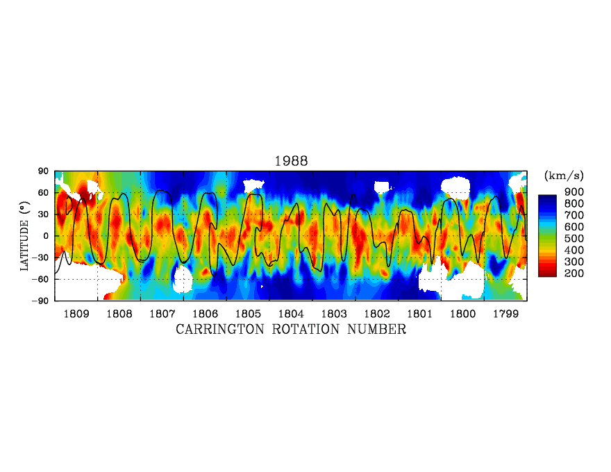
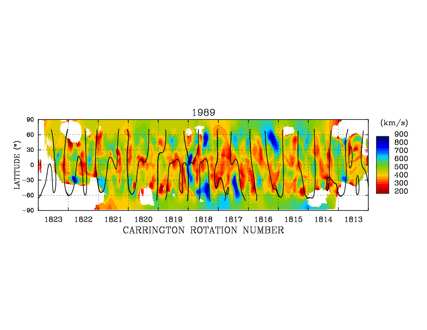
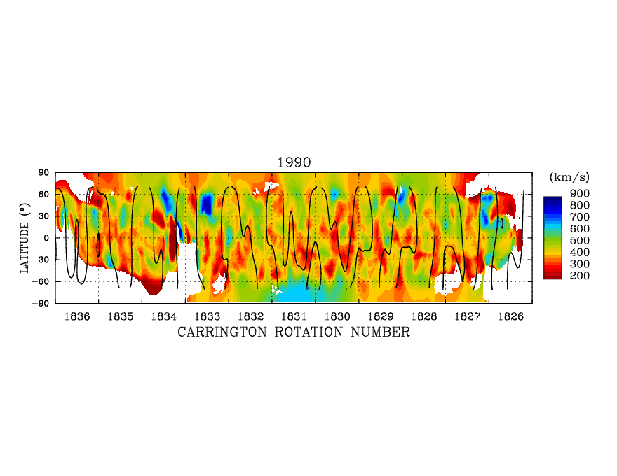
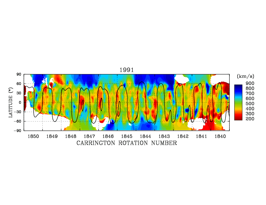
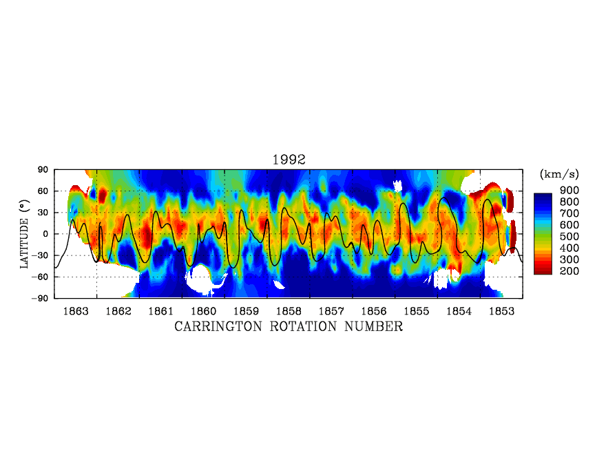
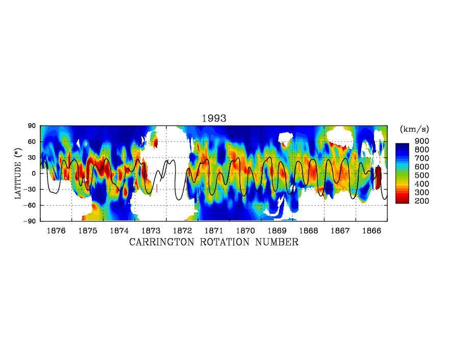
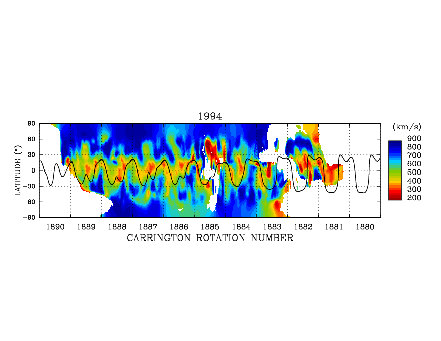
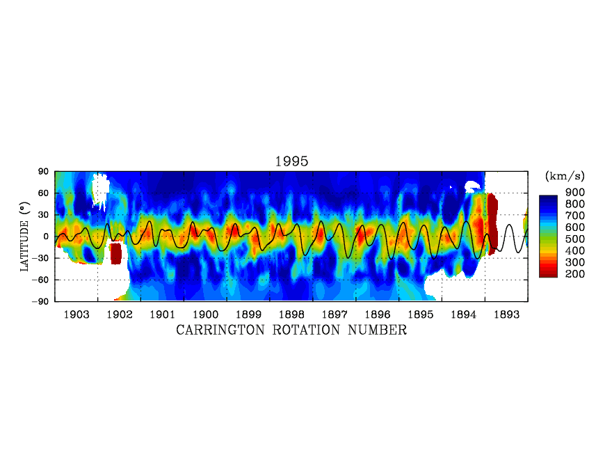
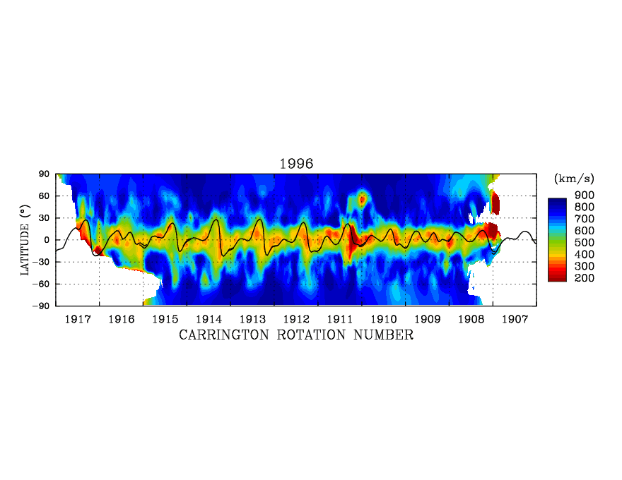
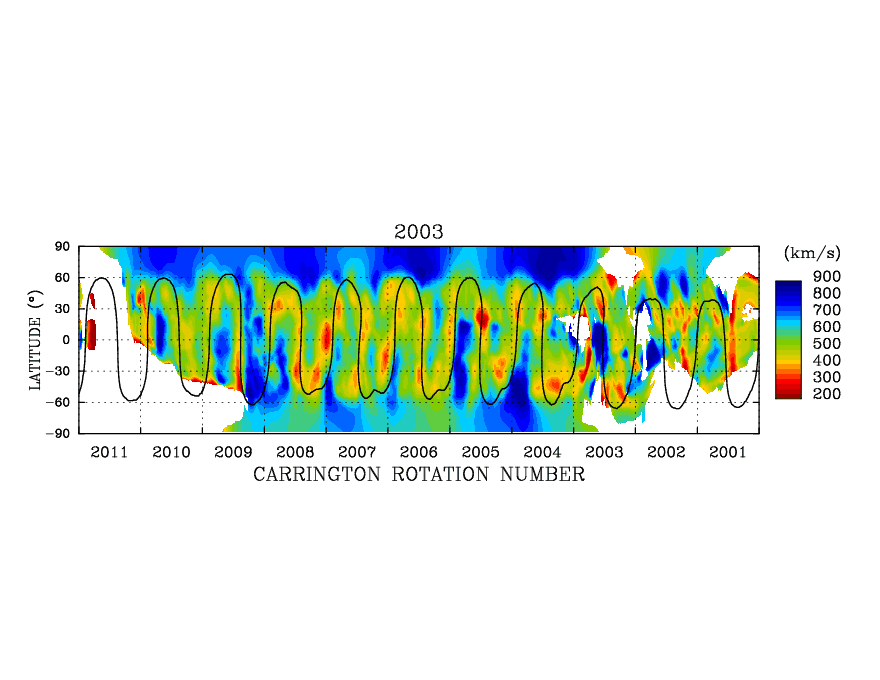
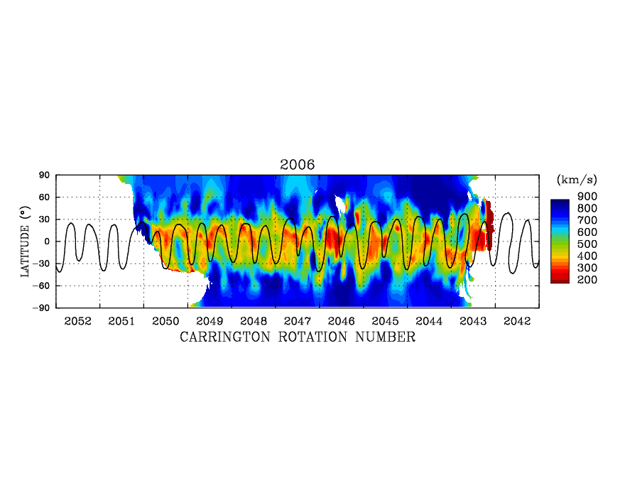
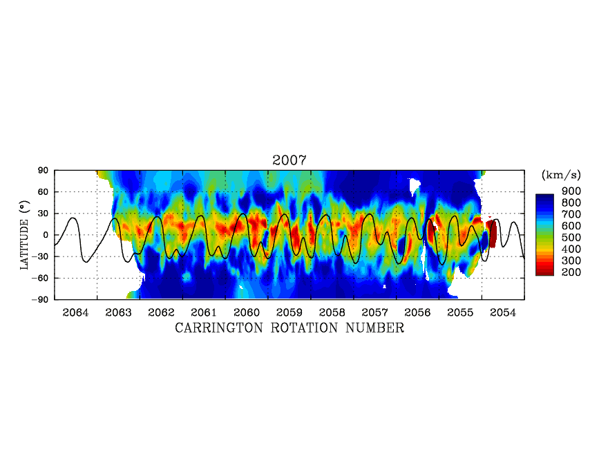
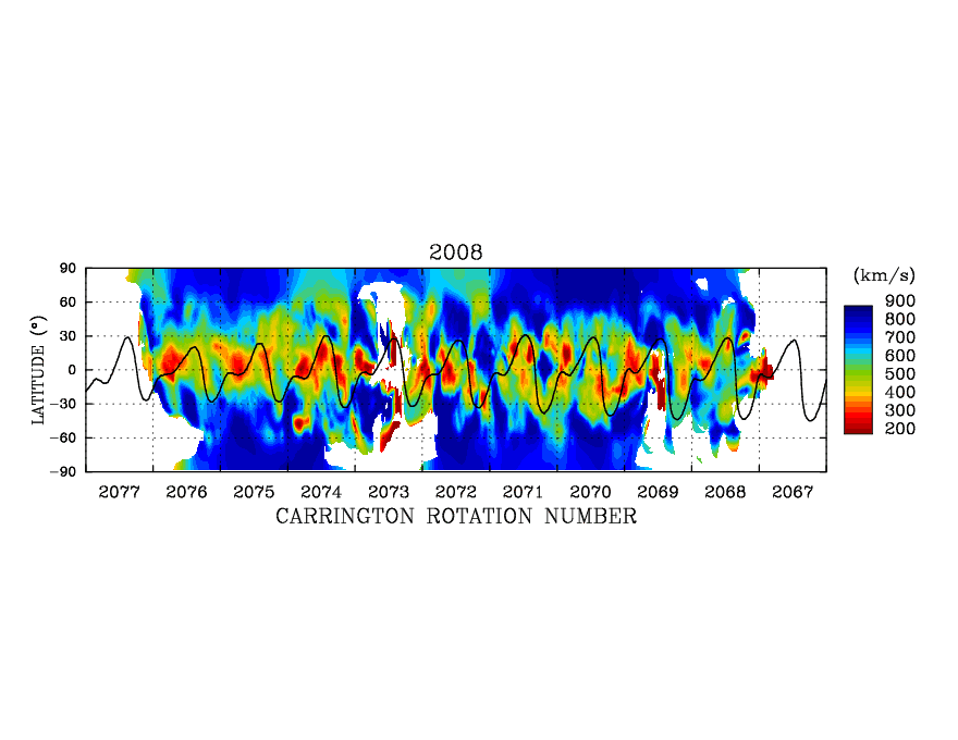
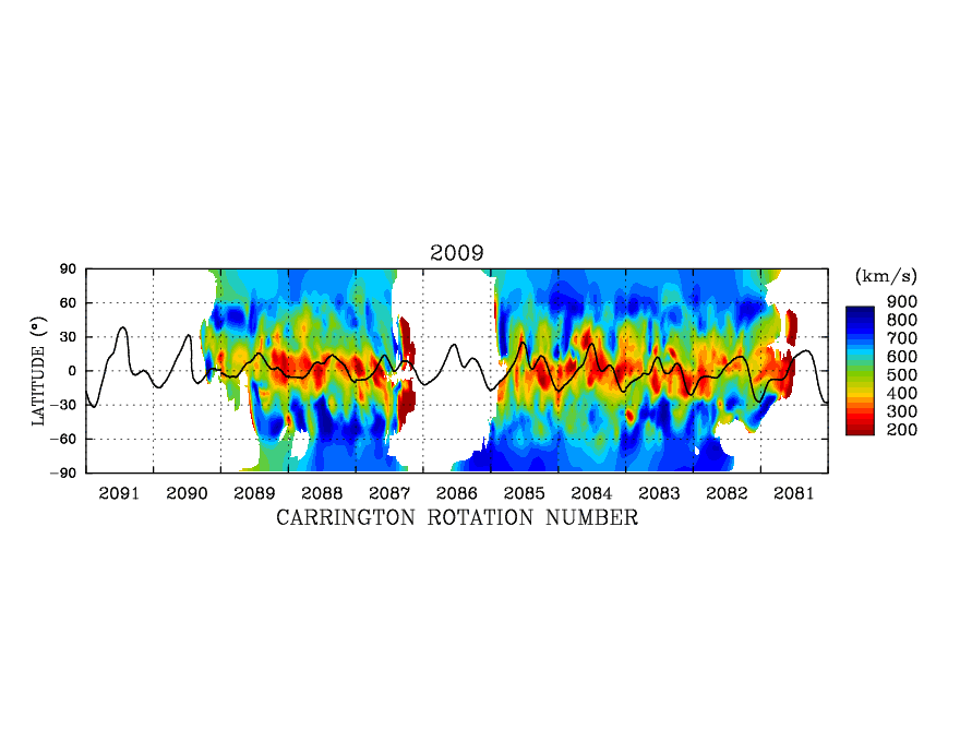
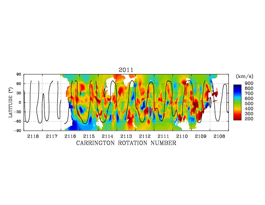
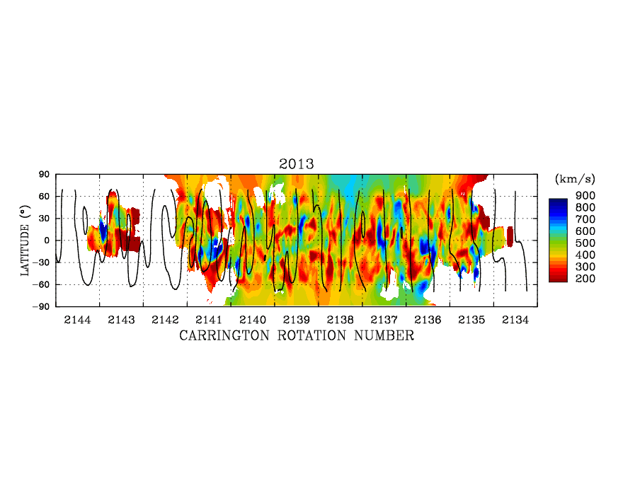
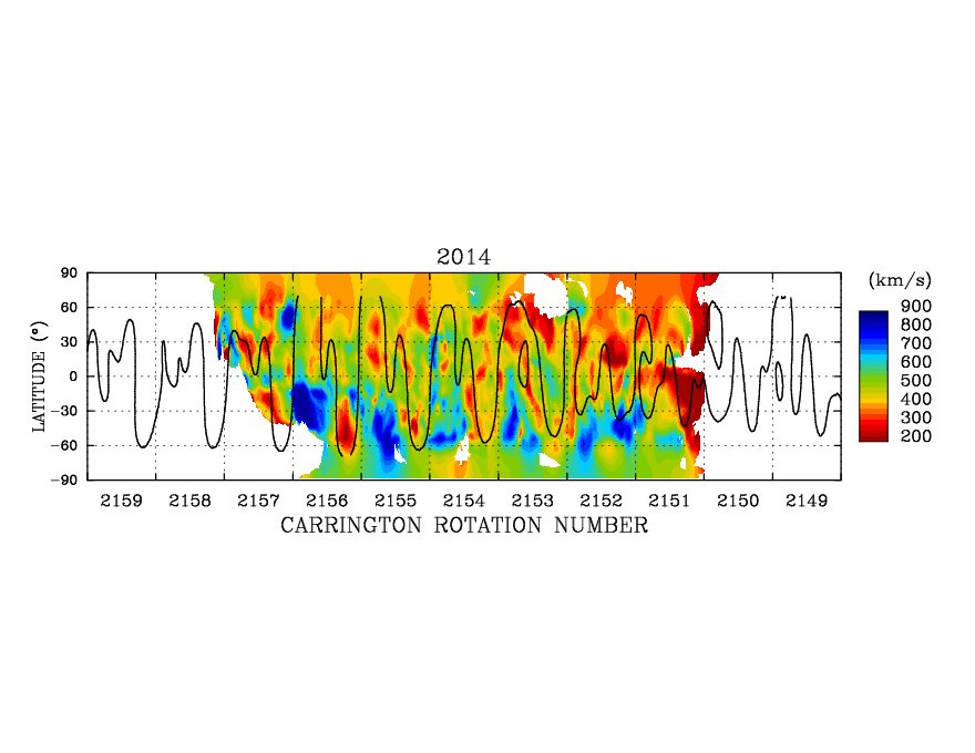
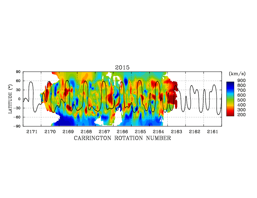
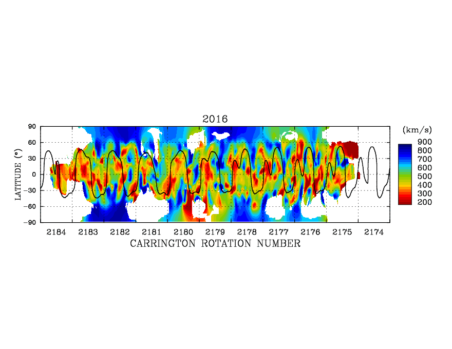
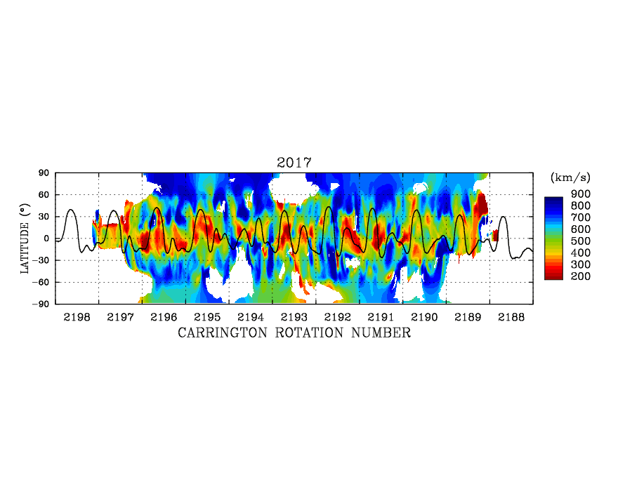
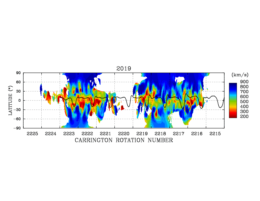
Annual Solar Wind Speed Maps
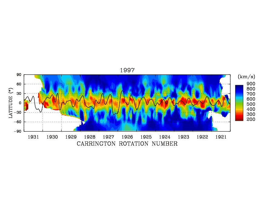
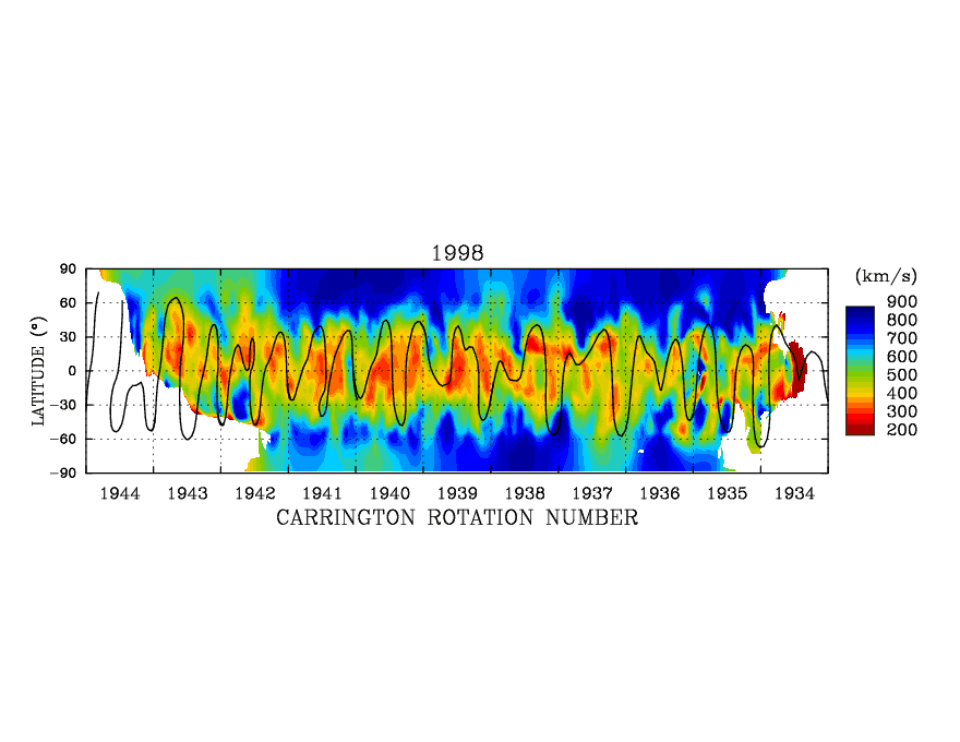
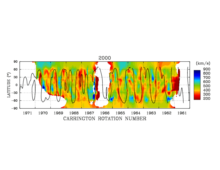
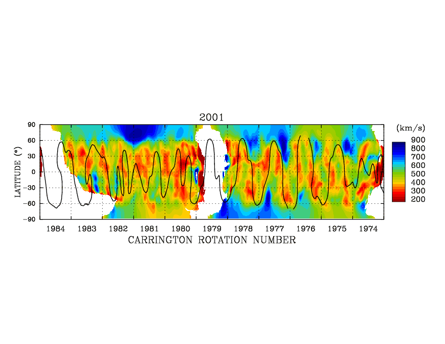
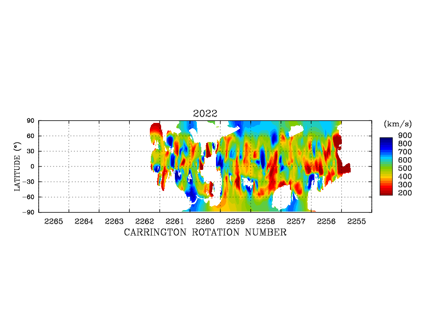
Synoptic Source Surface Maps in the Carrington Rotation Number versus Heliographic Latitude.
The Source Surface was assumed to be at 2.5 solar radii. The IPS-CAT method was applied to derive these maps. The data file for each year includes 11 CRs.
- 1985:gif,
dat 1
(Start CR 1759)
- 1986:gif,
dat 1
(Start CR 1772)
- 1987:gif,
dat 1
(Start CR 1785)
- 1988:gif,
dat 1
(Start CR 1799)
- 1989:gif,
dat 1
(Start CR 1813)
- 1990:gif,
dat 1
(Start CR 1826)
- 1991:gif,
dat 1
(Start CR 1840)
- 1992:gif,
dat 1
(Start CR 1853)
- 1993:gif,
dat 1
(Start CR 1866)
- 1994:gif,
dat 1
(Start CR 1880)
- 1995:gif,
dat 1
(Start CR 1893)
- 1996:gif,
dat 1
(Start CR 1907)
- 1997:gif,
dat 1,
dat 2
(Start CR 1921)
- 1998:gif,
dat 1,
dat 2
(Start CR 1934)
- 1999:gif,
dat 1,
dat 2
(Start CR 1947)
- 2000:gif,
dat 1,
dat 2
(Start CR 1961)
- 2001:gif,
dat 1,
dat 2
(Start CR 1974)
- 2002:gif,
dat 1,
dat 2
(Start CR 1987)
- 2003:gif,
dat 1,
dat 2
(Start CR 2001)
- 2004:gif,
dat 1,
dat 2
(Start CR 2014)
- 2005:gif,
dat 1,
dat 2
(Start CR 2028)
- 2006:gif,
dat 1,
dat 2
(Start CR 2042)
- 2007:gif,
dat 1,
dat 2
(Start CR 2054)
- 2008:gif,
dat 1,
dat 2
(Start CR 2067)
- 2009:gif,
dat 1,
dat 2
(Start CR 2081)
- 2010(N/A)
- 2011:gif,
dat 1,
(Start CR 2108)
- 2012:gif,
dat 1,
(Start CR 2121)
- 2013:gif,
dat 1,
(Start CR 2134)
- 2014:gif,
dat 1,
(Start CR 2149)
- 2015:gif,
dat 1,
(Start CR 2161)
- 2016:gif,
dat 1,
(Start CR 2174)
- 2017:gif,
dat 1,
(Start CR 2188)
- 2018:gif,
dat 1,
(Start CR 2201)
- 2019:gif,
dat 1,
(Start CR 2215)
- 2020:gif,
dat 1,
(Start CR 2228)
- 2021:gif,
dat 1,
(Start CR 2241)
- 2022:gif,
dat 1,
(Start CR 2255)
Note: "dat 1" from the CAT analysis using only V data (Tokumaru et al., 922:73, 2021).
Sample Fortran program to read the data
***************************************************
PARAMETER (nlota=11,nlon=nlota*360,nlat=180)
c                    =11 rotations*360 deg
REAL      vg  (nlon,nlat)  ! for 11 rotations

Open(10,file=filename,status='old')
DO j=1,nlat
   DO i=1,nlon
      read(10,*) vg(i,j)
   ENDDO
ENDDO
Close(10)

*****************************************************
- References:
- Kojima, M., M. Tokumaru, H. Watanabe, A. Yokobe, K. Asai, B.V. Jackson, and P.L. Hick,"Heliospheric tomography using interplanetary scintillation observations, II. Latitude and heliocentric distance dependence of solar wind structure at 0.1-1 AU",Journal of Geophysical Research, 103, pp1981-1989, 1998.
- Kojima, M., M. Tokumaru, K. Fujiki, K. Hayashi, and B. V. Jackson,"IPS tomographic observations of 3D solar wind structure", Astronomical and Astrophysical Transactions, 26, No. 6, 467-476, 2007.
- Tokumaru, M., M. Kojima, and K. Fujiki, "Solar cycle evolution of the solar wind speed distribution from 1985 to 2008", Journal of Geophysical Research, 115, A04102, 2010 (doi:10.1029/2009JA014628).
- Tokumaru, M., M. Kojima, and K. Fujiki, "Long-term evolution in the global distribution of solar wind speed and density fluctuations during 1997-2009", Journal of Geophysical Research, 117, A06108, 2012 (doi:10.1029/2011JA017379).
Contact address